Planning the Virginia Nature Triathlon isn’t like signing up for a road race and showing up on race day. This is a journey through one of the most storied landscapes in America — along the James River, up into the Blue Ridge, and across miles of trail and open road. To do it right, you need more than a training plan. You need to understand the land itself.
Here are the books, apps, maps, and online resources that helped me plan this adventure.
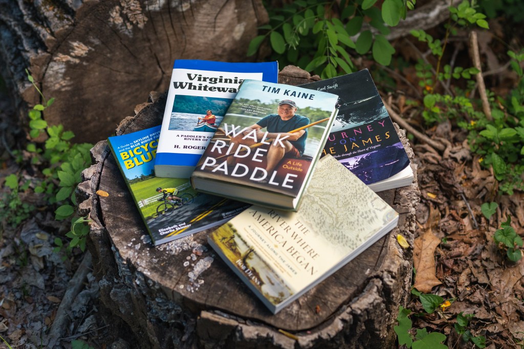
Books and Maps
Journey on the James by Earl Swift
If you want to understand the James River before you paddle a single stroke of it, start here. Swift’s narrative follows the entire length of the river, and reading it gave me a deep sense of the river’s character — its moods, its history, and the communities it has shaped over centuries. Equal parts travelogue and history lesson, this book will make every mile of my paddle feel more meaningful.
Virginia Whitewater by H. Roger Corbett
This is the practical paddler’s bible for Virginia rivers. Corbett maps out rapids, access points, hazards, and water levels across the state, and the James River sections are covered in excellent detail.
Walk Ride Paddle by Tim Kaine
Virginia U.S. Senator Tim Kaine’s personal account of his human-powered journey across the Commonwealth — on foot, by bike, and by paddle. Sound familiar? Kaine’s reflections on Virginia’s landscapes, people, and wild places are both inspiring and genuinely useful for planning. This one is required reading cover to cover before you go.
Bicycling the Blue Ridge by Elizabeth and Charlie Skinner
The definitive guide to cycling the 574-mile Skyline Drive and Blue Ridge Parkway corridor. The Skinners cover the route mile by mile, with detailed information on lodging, restaurants, bike shops, campgrounds, and elevation profiles.
The River Where America Began by Bob Deans
Deans writes beautifully about the James as the birthplace of English settlement in North America. This isn’t a guidebook, but it’s essential context. The James isn’t just a body of water — it’s a thread running through American history, and understanding that will make paddling it feel like more than exercise.
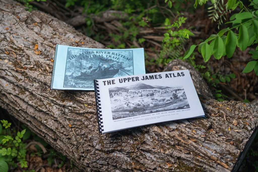
The Upper James Atlas by W.E. Trout III
W.E. Trout III’s meticulous atlases are some of the most useful river planning tools I’ve come across. This one covers the James from Lake Moomaw on the Jackson River all the way down to Snowden Dam — encompassing the stretch where the trip’s paddle leg begins. Access points, landmarks, campsites, hazards — it’s all here in extraordinary detail, and it was indispensable for planning the upper portion of the paddle.
The James River Batteau Festival Trail by W.E. Trout III
Another gem from Trout, this one picks up further downriver, tracing the historic batteau route from Lynchburg all the way to Richmond. The batteau festival celebrates Virginia’s river heritage, and this guide follows the route these flat-bottomed wooden boats once traveled. Together with the Upper James Atlas, it covers the lion’s share of the river.
Apps
FarOut — Virginia Nature Triathlon Package
FarOut is the gold standard for backcountry navigation, and their Virginia Nature Triathlon package is purpose-built for this exact adventure. The package includes maps for the Appalachian Trail, the James River, and Skyline Drive and the Blue Ridge Parkway — but not all of them are created equal.
The Appalachian Trail guide is exceptional. Extremely detailed waypoints cover water sources, shelter locations, towns, and resupply options at a level of depth that makes it an indispensable tool for the trail leg. I found myself referencing it constantly.
The cycling and paddling maps, however, leave a lot to be desired. They’re little more than maps with a line on them — functional for basic orientation, but lacking the depth you’ll want when navigating the river or planning daily mileage on the road. This is what ultimately led me to seek out additional resources for those legs of the journey.
Blogs, Podcasts, and Videos
Blog: James River Dam Portages
This blog covers the one stretch of the James that falls between the two Trout atlases: the section from Snowden to Lynchburg, a corridor defined by a series of dams that present serious challenges for paddlers. The author documents portage options around each obstacle with hard-won, on-the-ground detail you simply won’t find in any book or app.
Reading it was eye-opening — and ultimately convinced me to skip this section entirely. The dams on this stretch are no joke, and the author is candid that even they were unable to self-portage around all of them. That’s exactly the kind of honest, practical information that can keep you out of a dangerous situation on the water. If you’re considering paddling the Snowden–Lynchburg corridor, read this blog before you decide.
Video: Walk, Ride, Paddle Webinar – James River Association
Podcast: Tim Kaine – “Walk Ride Paddle: A Life Outdoors” (Episode 29)
Podcast: Tim Kaine’s ‘Virginia Nature Triathlon’ on Virginia Outdoor Adventures
Final Thoughts
The Virginia Nature Triathlon asks a lot of you — physically, logistically, and mentally. But the planning process, guided by resources like these, is part of what makes the experience so rich. Every book I read, every map I downloaded, every blog post I found at midnight helped me feel more connected to the landscape I was about to travel through.
If you’re planning your own attempt, I hope this list gives you a solid starting point. And if you know of any indispensable resources I missed, drop me a line

Leave a comment