• Day 72: Paddling Update

    Day 72: Paddling Update

    Thursday morning I left Powhatan State Park with the goal of reaching Boshers Dam just outside Richmond by evening. I stopped at Maidens Landing early to recharge my electronics and jump on a conference call for a project I’ve been working on this summer. The paddle was mostly uneventful after that, except for a surprise Class II when I went over the remnants of Maidens Adventure Dam.

    Fifteen miles in, I reached the pool behind Boshers Dam and the entire character of the river changed instantly. Stately homes, country club property, jet skiers, water skiers, fishing boats, and people tubing behind power boats replaced the quiet banks I had grown used to. For the first time on the journey I had to paddle through constant wake. It wasn’t fun at the time, but I figured it was good practice before hitting the tidal section.

    I still had ten more miles to go that evening. By the time I reached Boshers Dam it was dark, and finding the takeout just twenty feet upstream on river left near the fish ladder made for a dicey approach. I dragged my boat onto the dam and cowboy camped on the concrete next to the fish ladder.

    The next morning I portaged around Williams Dam. Since it’s only about five feet tall and the portage trail was sand, it made for an easy drag.

    A few days earlier, I had contacted Riverside Outfitters in advance. I was connected with raft guide Liz, who told me they could take me down the lower falls in a raft, but they wouldn’t be able to run the upper falls because of the low water. That section would be up to me.

    After portaging Williams Dam, I ran the upper falls myself. It was mostly straightforward, though the FarOut guide didn’t mention two two-foot drops over pipes that I had to navigate around the edges.

    Afterward, I dragged my kayak a good distance through a low side channel to reach the Reedy Creek takeout, where I ordered twenty-six dollars worth of McDonald’s from a picnic table while I waited for the rafting crew. The rafting with Liz was a lot of fun. We ran the lower falls side by side while another raft carried four friends from across the East Coast. The highlight was jumping off a rock into the river.

    At 14th Street I asked Liz if I could leave my kayak overnight so I could get a hotel room. She connected me with owner Matt Perry, who had already heard about my trip and immediately let me store my kayak inside their fence. That night I took one of the greatest showers of my life, cranked the AC, ordered Jimmy John’s, and got to bed early.

    Saturday morning I was back at the outfitters at 8 AM. Matt helped me launch. The first day on the tidal section after leaving Richmond was striking — giant barges loading gravel, large power plants lining the shore, but also tons of eagles and ospreys constantly flying overhead. A few hours later I stopped at Osborne Landing for lunch at the Lily Pad Restaurant and a couple of beers. While I was there I saw that Matt had posted about my journey.

    That evening at the Gravel Pits, I received a message from Justin, who had filmed a documentary called Headwaters Down about paddling the same stretch of the James from Iron Gate to Fort Monroe. He asked if I needed anything and ended up giving me a detailed custom itinerary for camping on the lower James, along with advice on navigating the heavy marine traffic around Newport News.

    That night at the Gravel Pits, fisherman Dwayne also recognized me from Matt’s post.

    Sunday I paddled to Lawrence Lewis Park, where I had reserved a primitive campsite. When I arrived, the boat ramp manager had no idea they even offered camping. After thirty minutes of phone calls, he pointed me to a picnic area a quarter mile up the road. Not wanting to haul my gear that far or leave my kayak behind, I slept on a picnic table by the water. While there, I also ran into another fisherman who recognized me from Matt’s posts.

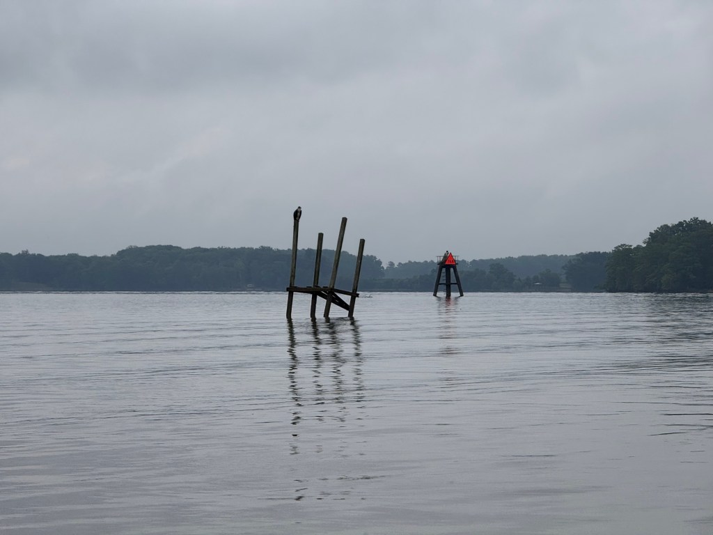
    Monday I woke up at 5 AM for the 20-mile paddle to Chickahominy Riverfront Park. I encountered one-foot swells much of the way, and despite leaving at high tide I hit headwinds on every bend of the river. It took me eight hours to cover those twenty miles.
  • Day 65: Ferry Crossing to Chillissees’ Falls

    Day 65: Ferry Crossing to Chillissees’ Falls

    I broke camp at 6:30 this morning and was on the water by 7. I quickly covered the six miles down to Scottsville and stopped at James River Reeling and Rafting to charge my electronics. While the batteries were charging, I walked into town in search of breakfast. Not a single restaurant was open yet, so I settled for a coffee shop and spent $13 on an iced mocha and a small blueberry muffin. On the way back to the outfitter, I stopped at a gas station hoping for something more substantial and ordered a chicken biscuit for $6.70. It turned out to be little more than a large chicken nugget sandwiched between something resembling a bun. I ate it begrudgingly.

    Back at James River Reeling and Rafting, I followed their recommendation and called a rafting company in Richmond. They were enthusiastic about my trip and quickly arranged a shuttle for my gear past the falls on Friday, along with a spot for me in one of their rafts. It was a huge relief to have that logistics piece settled.

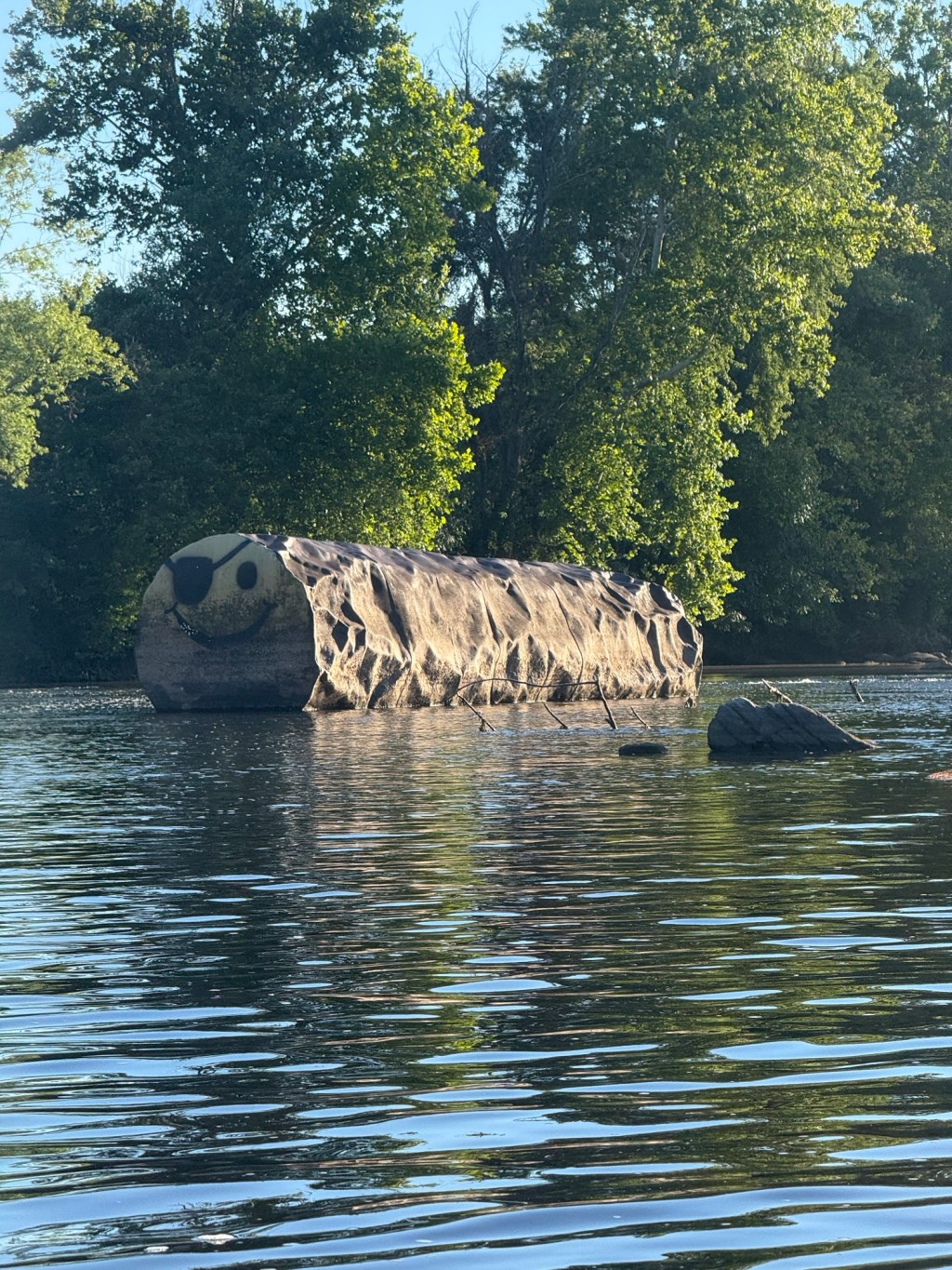
    Back on the river, I still had about 20 miles to go to reach my daily goal. I spent the early afternoon paddling through the remnants of yesterday’s thunderstorms, but the clouds finally parted around 3 PM just as I approached the Seven Islands stretch. The FarOut guide recommended staying south of the islands, but I followed the Batteau festival maps and took the northern route instead. It was the best decision I’ve made in a while. What followed was easily the most fun three miles I have paddled on this entire journey: multiple Class II slaloms and a mile-long stretch of 200-year-old Batteau sluices that propelled me through at nearly 10 mph. It was exhilarating.

    At the 20-mile mark, I pulled over at the New Canton boat ramp to bathe, recharge my watch, and send an email to the James River Association requesting guidance on camping and resupply options as I approach the tidal section. I then hopped back in the boat and finished the final miles to hit my 25-mile goal for the day.

    By 8 PM I spotted a nice flat piece of ground on river right and set up camp for the night. It was a solid day with good miles, fun whitewater, and important logistics taken care of. Onward toward the falls tomorrow.

  • Day 64: Paddling Update

    Day 64: Paddling Update

    Thursday wrapped up my time on the Upper James with an eventful finish at Snowden. After an impromptu swim at Balcony Falls from eddying out too quickly, I was more than ready for a break. Friday I took a rest day in Bedford to restock supplies and mentally prepare for the next leg: Lynchburg to Richmond.

    Saturday, Steve dropped me off at the Amherst County boat ramp near Lynchburg, where I launched onto the Middle James right as the 41st annual James River Batteau Festival was kicking off. I had the privilege of paddling alongside the batteaux for the first day down to Galt’s Mill. While I would’ve loved to join their eight-day leisurely float, time isn’t on my side, so I kept pushing.

    Sunday I aimed for a 25-mile day to James River State Park. Thanks to the dam release the day before, the batteaux had decent water through Lynchburg, but we weren’t so lucky. After Bent Creek, the river dropped to just two inches in spots, forcing me to drag my kayak over a quarter mile of shoals. Still made it to the park around 6 PM, set up a discreet camp at the boat ramp, and slept like a rock.

    Monday, the dragging continued. I set out hoping for 30 miles to Scottsville but fell five miles short. About five miles before camp I stopped in Howardsville at a general store for snacks and water. Not long after, the skies opened up and it stormed on and off the rest of the day. I tried waiting it out under a tree, but quickly realized that wasn’t happening, so I just paddled through the storm.

    Tonight I’m tucked into a stealth campsite at a defunct ferry crossing, and it’s a big milestone: my 1,000th mile of the journey. With roughly 200 miles left and my finish target of July 2nd, I’ve got 10 days to average 20 miles a day. After two solid 25-mile days, it’s all about early starts and late finishes from here.

  • Day 57: Gala to Horseshoe Bend

    Day 57: Gala to Horseshoe Bend

    I was on the water a little after 8:30 this morning from the Gala campsite at mile 11.8. The day started slow — a mix of easy Class I rapids and long, deep pools that had me pedaling steady.

    A couple hours in I passed Eagle Rock and barely saw any signs of civilization from the river. Just me, the kayak, and a pair of otters playing in the water near shore.

    Early afternoon I reached Gwyn Lock, an old canal lock dam that creates a fun little rapid. Ran it clean, then immediately pulled out on river left right at the end of a massive stone guard wall. Made that my lunch spot.

    The late afternoon brought some of the best scenery yet — towering cliffs rising up around every bend, a few more Class I’s, and one straightforward Class II that gave me no trouble.

    But the real highlight was the stretch where the railroad, instead of following the river’s crazy meandering oxbows, cuts straight through the mountain. Turns out those railroad trestles were originally built as aqueducts for the canal boats, so they could float through the mountain instead of paddling an extra three-mile loop. Pretty wild to think this whole upper section from here down to Buchanan was never finished — boats never actually ran through these canals before the railroad took over the right-of-way.

    I pulled into Horseshoe Bend at mile 29.1 right around 4 o’clock. The campsite Twin Rivers Outfitters picked out for me was perfect — I could park the boat within twenty feet of my tent. Cooked up some lasagna, ate like a king, and quickly fell asleep.

    Seventeen miles down, and the river just keeps getting better.

  • Day 56: The Paddle Begins

    Day 56: The Paddle Begins

    On Friday, as I finished the final miles of the biking leg near the Virginia-North Carolina line, my buddy Clayton rolled up from Asheville to meet me. We loaded my bike into his 4Runner and headed to Smith Mountain Lake, where my longtime friend Steve let us borrow his lake house for the weekend.

    We tested out the kayak, installed the new sun canopy, swam in the warm water, visited Natural Bridge, explored VMI and Washington & Lee, stopped by the National D-Day Memorial, and enjoyed some great meals together. It was the perfect way to recharge before the paddling leg began.

    On Sunday morning, after an early breakfast at the North Star Restaurant in Buchanan with Steve, Clayton drove me up to the river and helped me unload. I put in on the Cowpasture River two miles above where it joins the Jackson to form the James. A local at a convenience store had recommended that put-in, and it was the right call—the water was crystal clear and beautiful.

    Everything changed at the confluence. The Jackson runs dark from a paper mill upstream, so the James starts out the color of iced tea. I decided right away I wouldn’t swim in it or drink from it.

    The first day brought two Class II rapids, Surprise and The Squeeze. The Squeeze was the real thrill, an S-curve with a big boulder to dodge. The kayak handled everything beautifully, and the pedal drive made quick work of the slow, deep pools.

    Two thunderstorms rolled through during the day. When I first saw the price tag on that canopy, two hundred and fifty dollars for some aluminum poles and silnylon felt ridiculous. But after it kept me out of the brutal sun and then protected me from the rain during both storms, I’m officially calling it a steal.

    I pulled over for the first thunderstorm under an old stone train trestle while a CSX coal train thundered overhead. After thirteen and a half miles and about seven hours on the water, I pulled into Twin River Outfitters’ Gala Campground around eight o’clock. The only clean water I could find all day was from an Exxon station half a mile up the road, so I hiked up, filled my two-liter bag, filtered it back at camp, cooked some Mountain House lasagna, and crashed hard.

    Thirteen miles down, a whole lot of river still to go.

  • Day 2: Zero Day

    Sometimes a rest day isn’t really a rest day. Yesterday was a planned day off — but not entirely from responsibility. I had a final class to teach remotely, my students presenting their capstone projects, and I wasn’t about to miss it just because I happened to be living out of a backpack in the mountains of southwest Virginia.
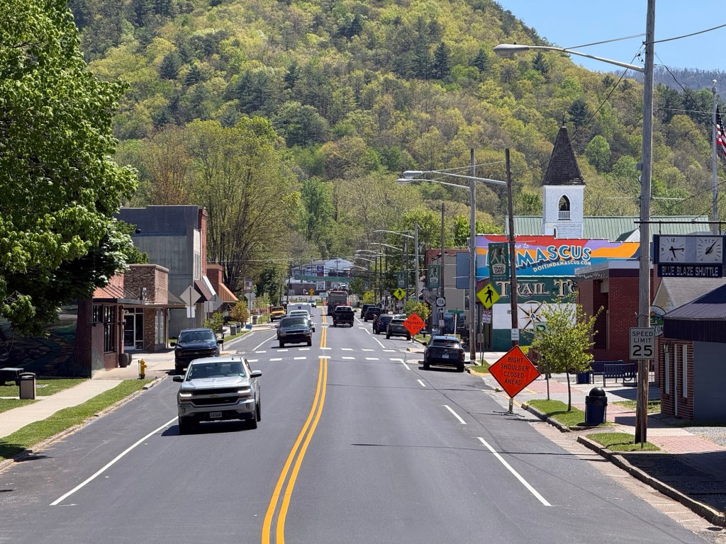
    Not wanting to spend the whole day cooped up at Lady Di’s, I laced up my shoes and headed out for a walk down to the Food City, a grocery store about a mile and a half outside of town. The walk itself became its own small adventure — I slowed down to read the historic placards that line the streets of Damascus, ducked into a shop or two, and let myself move at the kind of unhurried pace that a trail town naturally invites. There was nowhere to be and no miles to make.

    Damascus

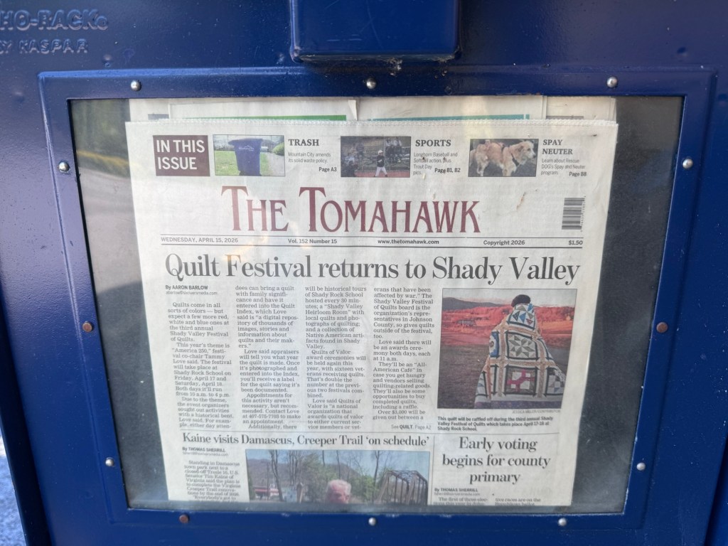
    Food City delivered exactly what a hungry hiker needs: a bag of chips, a sandwich, and a chocolate milk. Simple pleasures. Out front of the store, I could’ve been mistaken for a homeless man. As I was eating my lunch on the ground beside a newspaper box, my eye landed on the front page. The face staring back at me was Tim Kaine who had been in Damascus just a week earlier to provide an update on a $250,000,000 federal project to rebuild a large section of the Virginia Creeper Trail.

    The trail had been devastated two years prior by Hurricane Helene, which tore through the region and took out significant stretches of the beloved rail-trail corridor.

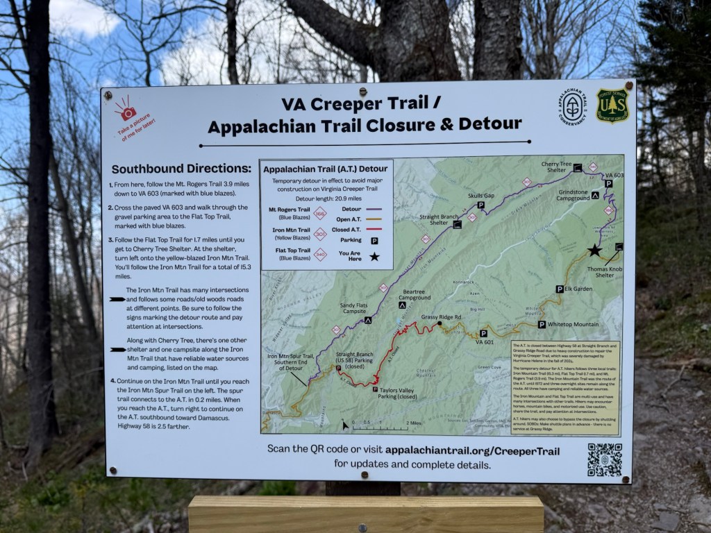
    On the walk back to Lady Di’s, I stopped into the Appalachian Trail Conservancy’s regional headquarters, mostly out of curiosity. That’s where I got the news that would reshape the next leg of my hike. A 22-mile detour is currently in effect off the Virginia Creeper Trail, where crews are in the process of replacing all of the trestles along the route. The alternative path runs along the Iron Mountain Trail — and as it turns out, that’s not just any reroute. The Iron Mountain Trail is the original Appalachian Trail through this area, the route that thru-hikers followed before the AT was redirected onto the Virginia Creeper Trail corridor in the 1970s.

    It’s a rugged, ridgeline path that trades the gentle, converted railroad grade of the Creeper for something older and steeper — more in keeping with the character of the AT as most people know it.
    In a way, the detour is a step back in time. And I found myself looking forward to it.

  • Day 1: The Road to Damascus

    Day 1: The Road to Damascus

    My first day on the trail began not at dawn, but the afternoon before. Clayton dropped me off at Logap, Tennessee around 2PM, about eleven miles shy of the Virginia border, giving me just enough daylight to make it up to Abingdon Gap Shelter. I strung up my hammock and settled in, but sleep came in restless waves — an hour or two at a time — until pale morning light finally crept through the trees.

    It was chilly. The thermometer hovered somewhere in the high thirties, maybe low forties, and that was reason enough to pull the quilt tight and drift off again. I didn’t rise for good until 8AM, coaxed awake not by an alarm but by the sound of hikers passing just a few feet from where I hung.

    The morning was easy, almost meditative. Five miles of ridge walking toward the Virginia-Tennessee border, the kind of hiking that lets your mind wander while your legs find their rhythm. The forest came alive with native wildflowers, and among them, a dozen or so lady slippers — delicate, improbable things tucked along the trail like little surprises. The canopy shifted as I moved — rhododendron and mountain laurel crowding the understory, eastern hemlock standing tall and dark, sassafras throwing its odd mitten-shaped leaves into the mix.
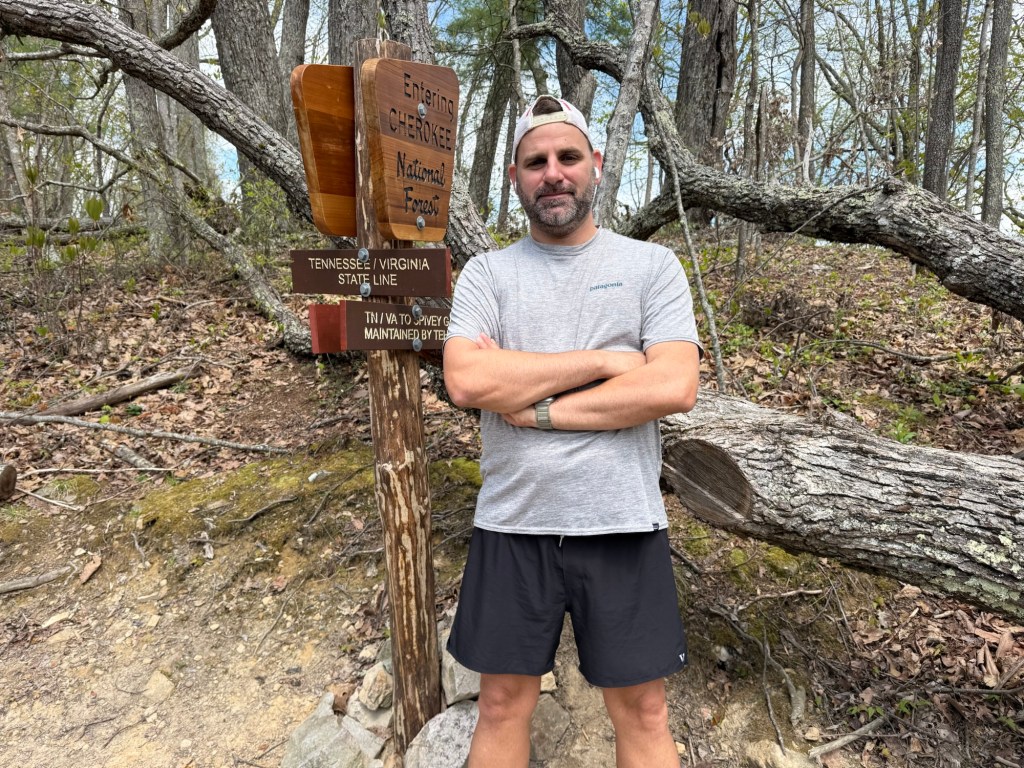
    I reached the state line around 12:30, and that’s where the day took its first real turn. Waiting there was Melissa, an ATC Ridge Runner working a 73-mile section up toward Mount Rogers. She snapped my photo and we talked for a while about her work on the trail — the kind of quiet, essential stewardship that keeps places like this intact. Then came my first trail magic of the trip: a few strips of homemade beef jerky, made by a friend of hers down in North Carolina. It was simple and perfect.

    The descent into Damascus brought one more good encounter. I fell in alongside a couple from Rhode Island — Jack and Sue, recently retired Navy veterans. We traded stories about service, about the particular world that military life creates, and about their son, currently serving in the Marine Corps.

    I rolled into Damascus right around 3PM, trail dust and all, and walked straight through town to Lady Di’s. The B&B is run by a former AT thru-hiker, which means the host understands exactly what you need when you come through the door — and exactly what you don’t need, which is anyone making you feel out of place for smelling like the woods. I’d stayed here during my 2023 hike and never seriously considered going anywhere else. Some places just earn that kind of loyalty.

    A shower first. Always a shower first. Then the easy, unhurried business of settling in and letting the day’s miles drain away. It didn’t take long before I’d fallen into conversation with some of the other hikers passing through — the way you do at places like Lady Di’s, where the shared experience of the trail makes introductions almost unnecessary.

    By evening we’d formed the kind of loose, spontaneous fellowship that the AT seems to manufacture out of thin air, and we wandered over to the Old Mill restaurant for dinner together. Good food, good company, and the particular satisfaction of a meal eaten after a full day on your feet.

  • Virginia Nature Triathlon Resources

    Virginia Nature Triathlon Resources

    Planning the Virginia Nature Triathlon isn’t like signing up for a road race and showing up on race day. This is a journey through one of the most storied landscapes in America — along the James River, up into the Blue Ridge, and across miles of trail and open road. To do it right, you need more than a training plan. You need to understand the land itself.

    Here are the books, apps, maps, and online resources that helped me plan this adventure.


    Books and Maps

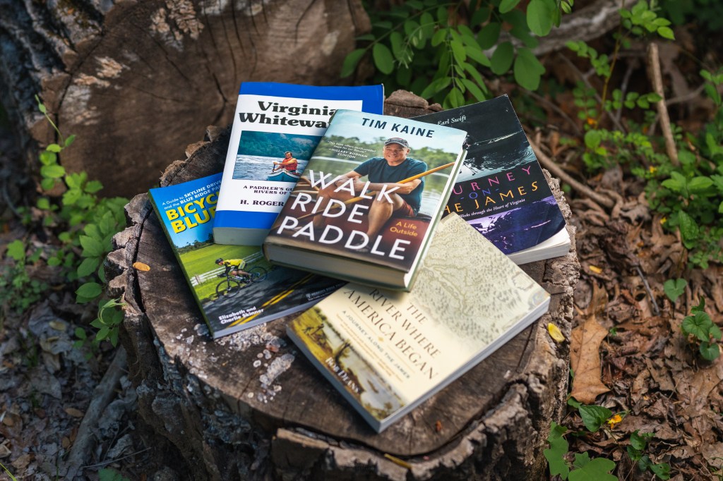
    Journey on the James by Earl Swift

    If you want to understand the James River before you paddle a single stroke of it, start here. Swift’s narrative follows the entire length of the river, and reading it gave me a deep sense of the river’s character — its moods, its history, and the communities it has shaped over centuries. Equal parts travelogue and history lesson, this book will make every mile of my paddle feel more meaningful.

    Virginia Whitewater by H. Roger Corbett

    This is the practical paddler’s bible for Virginia rivers. Corbett maps out rapids, access points, hazards, and water levels across the state, and the James River sections are covered in excellent detail.

    Walk Ride Paddle by Tim Kaine

    Virginia U.S. Senator Tim Kaine’s personal account of his human-powered journey across the Commonwealth — on foot, by bike, and by paddle. Sound familiar? Kaine’s reflections on Virginia’s landscapes, people, and wild places are both inspiring and genuinely useful for planning. This one is required reading cover to cover before you go.

    Bicycling the Blue Ridge by Elizabeth and Charlie Skinner

    The definitive guide to cycling the 574-mile Skyline Drive and Blue Ridge Parkway corridor. The Skinners cover the route mile by mile, with detailed information on lodging, restaurants, bike shops, campgrounds, and elevation profiles.

    The River Where America Began by Bob Deans

    Deans writes beautifully about the James as the birthplace of English settlement in North America. This isn’t a guidebook, but it’s essential context. The James isn’t just a body of water — it’s a thread running through American history, and understanding that will make paddling it feel like more than exercise.

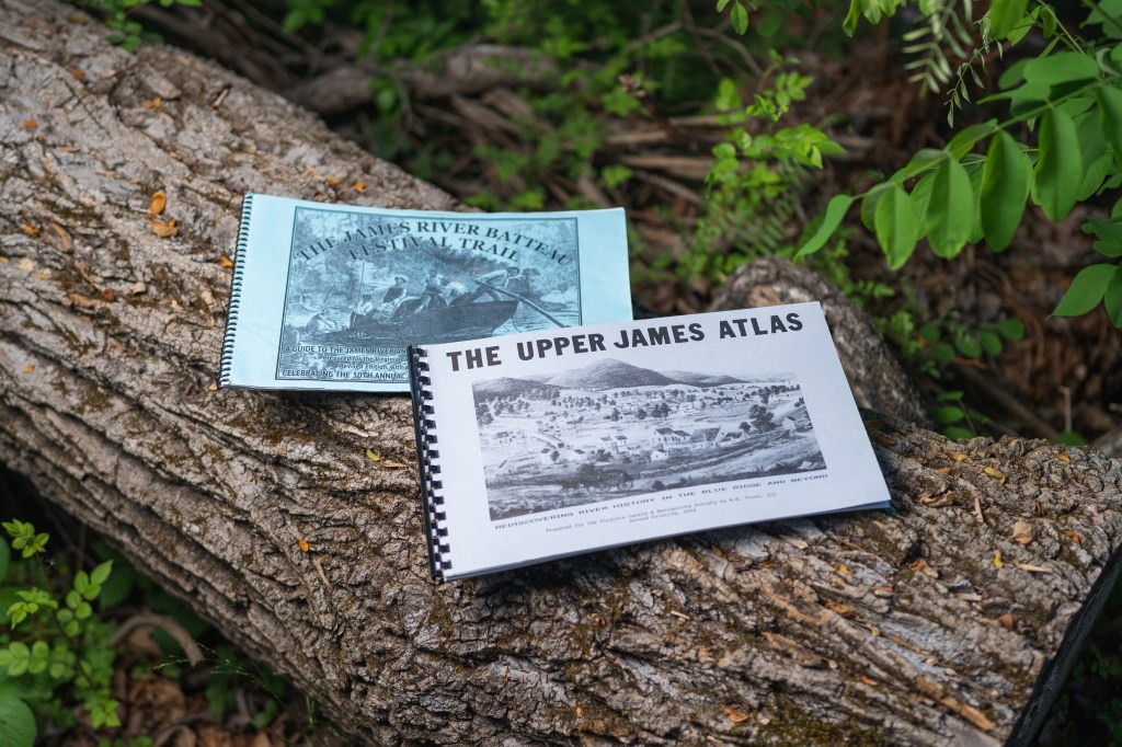
    The Upper James Atlas by W.E. Trout III

    W.E. Trout III’s meticulous atlases are some of the most useful river planning tools I’ve come across. This one covers the James from Lake Moomaw on the Jackson River all the way down to Snowden Dam — encompassing the stretch where the trip’s paddle leg begins. Access points, landmarks, campsites, hazards — it’s all here in extraordinary detail, and it was indispensable for planning the upper portion of the paddle.

    The James River Batteau Festival Trail by W.E. Trout III

    Another gem from Trout, this one picks up further downriver, tracing the historic batteau route from Lynchburg all the way to Richmond. The batteau festival celebrates Virginia’s river heritage, and this guide follows the route these flat-bottomed wooden boats once traveled. Together with the Upper James Atlas, it covers the lion’s share of the river.


    Apps

    FarOut — Virginia Nature Triathlon Package

    FarOut is the gold standard for backcountry navigation, and their Virginia Nature Triathlon package is purpose-built for this exact adventure. The package includes maps for the Appalachian Trail, the James River, and Skyline Drive and the Blue Ridge Parkway — but not all of them are created equal.

    The Appalachian Trail guide is exceptional. Extremely detailed waypoints cover water sources, shelter locations, towns, and resupply options at a level of depth that makes it an indispensable tool for the trail leg. I found myself referencing it constantly.

    The cycling and paddling maps, however, leave a lot to be desired. They’re little more than maps with a line on them — functional for basic orientation, but lacking the depth you’ll want when navigating the river or planning daily mileage on the road. This is what ultimately led me to seek out additional resources for those legs of the journey.


    Blogs, Podcasts, and Videos

    Blog: James River Dam Portages

    This blog covers the one stretch of the James that falls between the two Trout atlases: the section from Snowden to Lynchburg, a corridor defined by a series of dams that present serious challenges for paddlers. The author documents portage options around each obstacle with hard-won, on-the-ground detail you simply won’t find in any book or app.

    Reading it was eye-opening — and ultimately convinced me to skip this section entirely. The dams on this stretch are no joke, and the author is candid that even they were unable to self-portage around all of them. That’s exactly the kind of honest, practical information that can keep you out of a dangerous situation on the water. If you’re considering paddling the Snowden–Lynchburg corridor, read this blog before you decide.

    Video: Walk, Ride, Paddle Webinar – James River Association

    Podcast: Tim Kaine – “Walk Ride Paddle: A Life Outdoors” (Episode 29)

    Podcast: Tim Kaine’s ‘Virginia Nature Triathlon’ on Virginia Outdoor Adventures


    Final Thoughts

    The Virginia Nature Triathlon asks a lot of you — physically, logistically, and mentally. But the planning process, guided by resources like these, is part of what makes the experience so rich. Every book I read, every map I downloaded, every blog post I found at midnight helped me feel more connected to the landscape I was about to travel through.

    If you’re planning your own attempt, I hope this list gives you a solid starting point. And if you know of any indispensable resources I missed, drop me a line

  • A Month Out

    A Month Out

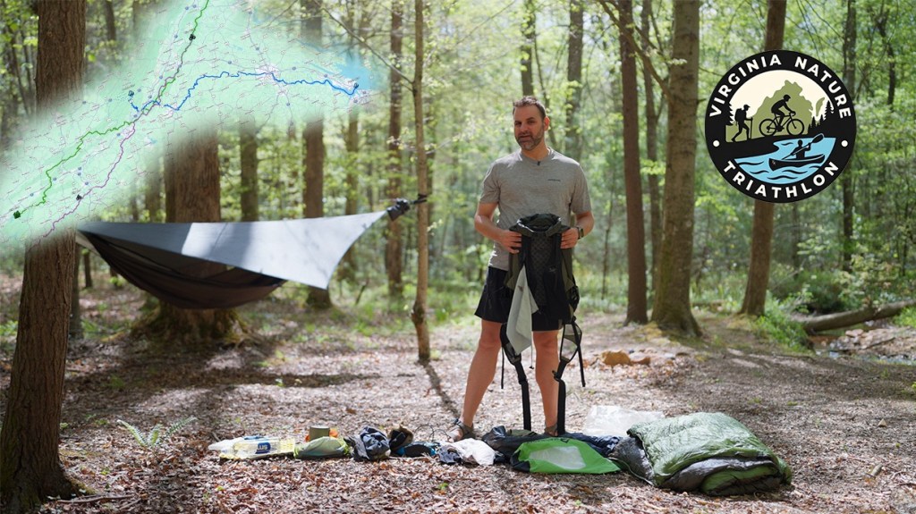
    In 2024, while walking the Camino de Santiago, I stumbled across Walk, Ride, Paddle: A Life Outside by U.S. Senator Tim Kaine — recommended by Audible as I walked. The book lays out the Virginia Nature Triathlon — Kaine’s self-made challenge that ties together the Appalachian Trail, the James River, and Skyline Drive and the Blue Ridge Parkway.

    What caught me wasn’t just the idea — it was the familiarity. I already knew those places. I’d walked Virginia’s portion of the Appalachian Trail three times. I’d paddled long stretches of the James River. The Parkway from Wintergreen to the Peaks of Otter was a familiar stretch of road.

    The idea stuck with me.

    So I’m going to try to do it all in one continuous push.

    Next month, I’ll set out to complete the Virginia Nature Triathlon end to end. The full route of 1,228 miles includes:

    • 559 miles hiking the Appalachian Trail across Virginia, from the Tennessee border near Damascus to Harpers Ferry, West Virginia.
    • 321 miles cycling Skyline Drive and the Blue Ridge Parkway, from Front Royal to the North Carolina border near Galax.
    • 348 miles paddling the James River, from its headwaters at Iron Gate to Fort Monroe on the Chesapeake Bay.

    Kaine spread his effort across several years. I’m aiming for something tighter — roughly 75 days, depending on weather, logistics, and how things unfold. I’m aiming to complete the trip in time to celebrate the Fourth of July in Washington D.C.

    I grew up in Virginia between Lynchburg and Forest, where the Blue Ridge Mountains were basically my backyard. I was an outdoor junkie and spent as much time outside as I could — hiking, climbing, biking, paddling, then doing it all over again the next day. In my teenage years, I’d spend two months each summer in the mountains, moving along ridgelines and dropping into valleys, camping wherever I could. Outside of summer, a month never went by where I wasn’t spending at least one weekend in the wilderness.

    At 14, I built a raft from scrap lumber and styrofoam and spent two days floating the James River alone.

    After graduating high school in 2002, I joined the Marines and deployed to Iraq twice. Upon exiting the service, I worked a defense contractor gig in Afghanistan for three years. When I returned to the States, I fell into a pattern of taking extended backcountry trips whenever I could — usually a few months at a time — heading for long trails or remote places.

    In 2013, I thru-hiked the Appalachian Trail. In 2014, I attempted to cycle the Southern Tier route from Florida to California, making it to Austin before stopping — enough to get my first real taste of long-distance cycling. I spent a summer wandering around Turkey and Egypt.

    In 2015, I tapped my GI Bill to return to school and four years later earned a journalism degree from the University of Florida. In 2020, as the pandemic took hold, I abandoned my newspaper job in Tampa and escaped west to the border of Mexico and California to hike the Pacific Crest Trail to Canada. After finishing, I returned home and joined the faculty at my alma mater as a lecturer.

    In 2023, after a cancer scare, I took a sabbatical and thru-hiked the Appalachian Trail for a second time. I’ve spent the past two summers in Europe hiking in Spain, Austria, Germany, England, and Sweden.

    These days I live in the Tampa Bay area. I teach a few classes each semester, serve as the data editor for a state politics wire service, and run a digital public records warehouse used by more than 1,200 journalists across Florida.

    Despite 20 years removed from my childhood home, Virginia has never really faded from my mind. The mountains, the trail, the river — they’ve been a constant reference point in my life. I’m very much looking forward to revisiting the landscapes of my youth.

    I’ll post updates here and on social media channels as I go — conditions on the trail, what the river is doing, notes from the road, and anything useful for someone thinking about doing the same. If you’ve spent time on any part of this route — especially the James River or the cycling sections — I’d love to hear from you.

    If you want more background on the challenge itself, order a copy of Tim Kaine’s book here. It’s a good read. He’s also given a multitude of hour-long interviews available through YouTube and podcast apps.